


Columbia Voting District, Randolph County, Arkansas
About
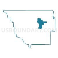
Outline

Summary
| Unique Area Identifier | 527945 |
| Name | Columbia Voting District |
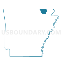
| County | Randolph County |
| State | Arkansas |
| Area (square miles) | 22.57 |
| Land Area (square miles) | 22.57 |
| Water Area (square miles) | 0.00 |
| % of Land Area | 100.00 |
| % of Water Area | 0.00 |
| Latitude of the Internal Point | 36.36820890 |
| Longtitude of the Internal Point | -90.93047210 |
Maps

Graphs
Select a template below for downloading or customizing gragh for Columbia Voting District, Randolph County, Arkansas


Neighbors
Neighoring Voting District (by Name) Neighboring Voting District on the Map
- Demun Voting District, Randolph County, AR
- Foster Voting District, Randolph County, AR
- Ingram Voting District, Randolph County, AR
- Rickardson Voting District, Randolph County, AR
- Running Lake Voting District, Randolph County, AR
- Siloam Voting District, Randolph County, AR
Top 10 Neighboring County Subdivision (by Population) Neighboring County Subdivision on the Map
- Demun township, Randolph County, AR (8,191)
- Richardson township, Randolph County, AR (805)
- Foster township, Randolph County, AR (665)
- Columbia township, Randolph County, AR (662)
- Siloam township, Randolph County, AR (294)
- Ingram township, Randolph County, AR (225)
- Running Lake township, Randolph County, AR (207)